
This cartographer added elevation data to an old map of his home in Tromsø, Norway, and the result is this gorgeous piece. twitter ![]() redit
redit ![]()
I have a special interest in Tromso having been there and have collected remote sensing data there off and on.
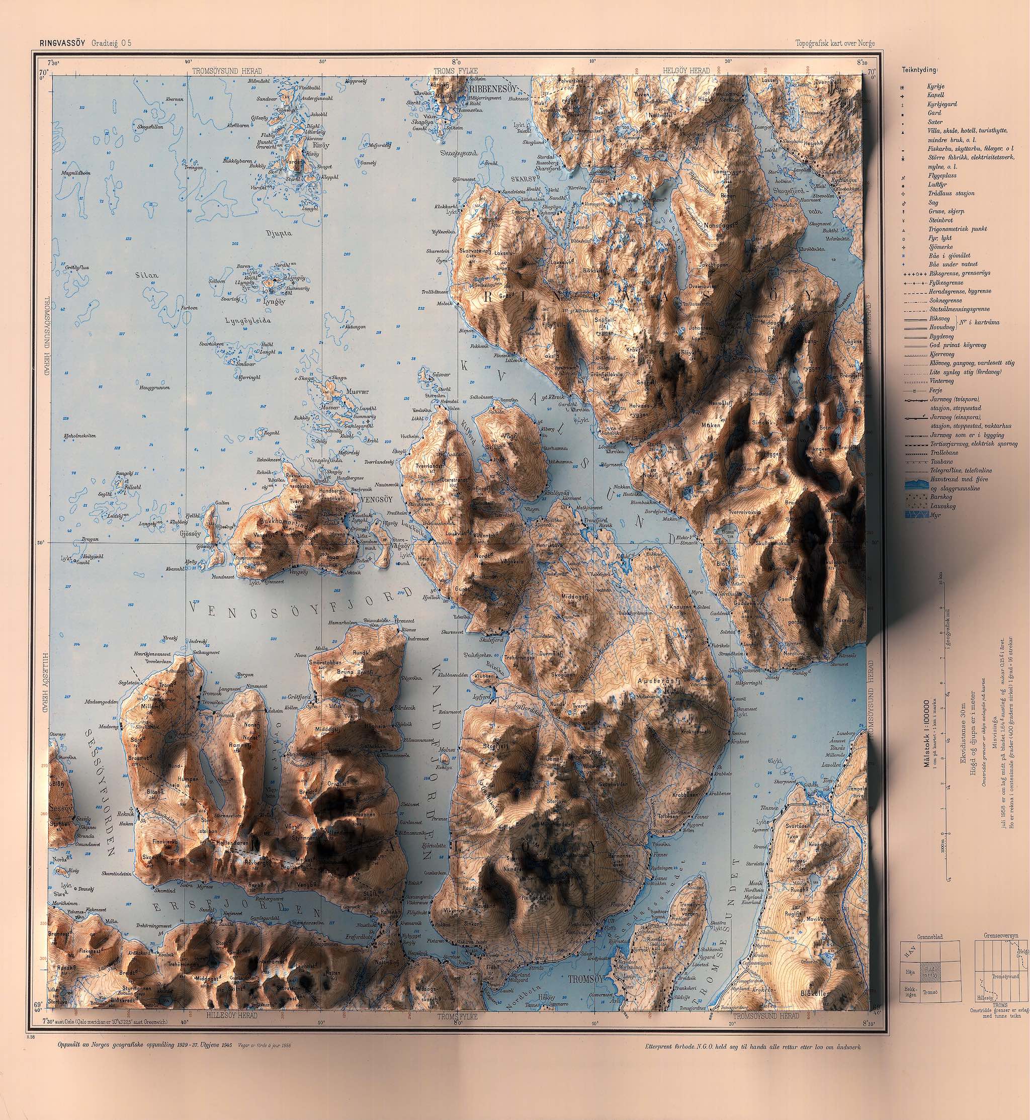
I had trouble spotting Tromso on this map so I started comparing geography with google maps. Tromso is on an island which appears at the bottom left of the historic map and is cut off above Tromso. I will illustrate this using wiki's Map plugin.
Careful reading shows that this is the Ringvasoy quadrangle. I save as assets a slightly smaller map shown above and an excerpt of this showing the half of the island I do have.
pages/historic-tromso
I estimate the geographic bounds of interest and create a Map with this BOUNDARY. I estimate the extent of my excerpt and insert it with the OVERLAY option.
I can now pan and zoom the two maps together. I find geographic features that should align but don't. For two in corners I place markers on the feature and then another where it should be. I now should have enough information to align the two maps more closely.
BOUNDARY 69.6450987, 18.8282172 BOUNDARY 69.7128208, 19.0944185 OVERLAY http://found.ward.bay.wiki.org/assets/pages/historic-tromso/ringvassoy-excerpt.jpg 69.668396,18.8854943 69.725546,19.0372503 69.6804058, 18.8975414 69.6782299, 18.8941881 69.6996457, 19.0193389 69.6965486, 19.0231221
When I decide I am going to tell this story here I decide to tighten up the view into my work before going further. I adjust the pan and zoom until I have a nice view and then place two more markers at the bottom left and top right of the desired view. I edit the Map markup and move these last to coordinates to refine the Boundary I made before.
I write an html script to perform this computation. I can see that this is going to require a lot of experimentation so I have the script fetch the original markup and show the improved markup in a Frame. github ![]()
http://found.ward.bay.wiki.org/assets/pages/historic-tromso/markup.html HEIGHT 120
Now copy-paste this computed markup into a new map.
BOUNDARY 69.6450987 18.8282172 BOUNDARY 69.7128208 19.0944185 OVERLAY http://found.ward.bay.wiki.org/assets/pages/historic-tromso/ringvassoy-excerpt.jpg 69.6662201, 18.882141 69.72244889999999, 19.041033499999998
I'm displacing overlay corners by deltas measured near but not at those corners. I'm also ignoring any rotation or projection differences which are even smaller errors.